Color Aerial Photos
Flathead Basin
Photographs of the Flathead Basin were taken between September 23 and September
25, 2009.
These photos are in MrSID format and Montana State Plane coordinates, datum NAD83, HARN. The
horizontal units of the coordinate system are U.S. Survey feet.
These photos are available for download in two formats:
- 8 large (400-750 Mb) images. Click here
to download these.
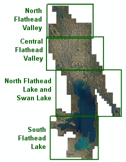
- 780 individual images that each cover about 700 acres. For this web site, groups
of 6 files were placed together in zip archive files. Select your area of interest
below to see a map of the files that may be downloaded.
These data may be viewed by anyone with our Online Map Viewer or accessed as
web services that allow seamless access to the data without the need
to download individual tiles. This web site is intended for quick access to data
for a small area. If you need this data for a large area sent to you, please contact the State Library.
