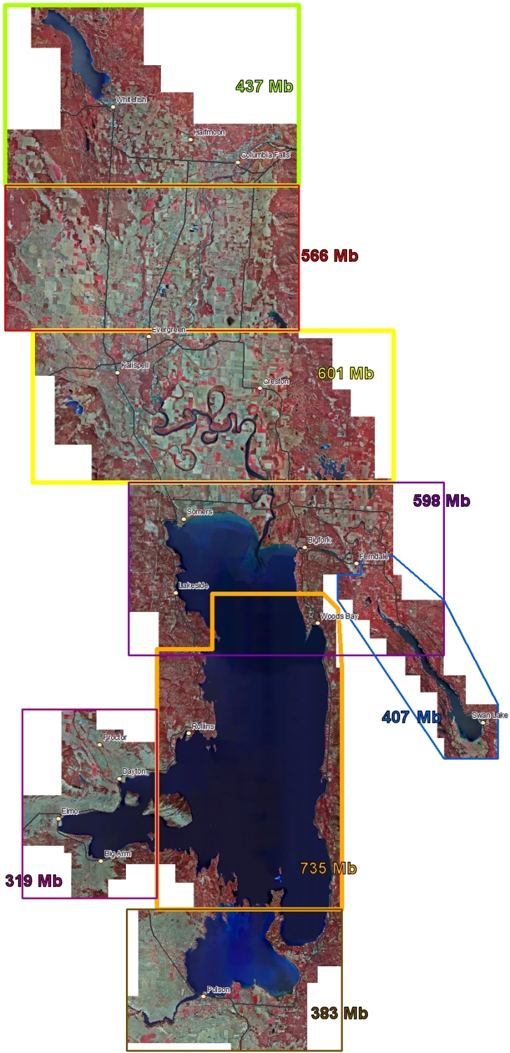
Color Infrared Aerial Photos
Flathead Basin - Color Mosaics
Photographs of the Flathead Basin were taken between September 22 and September
29, 2009.
Click on one of the boxes in the map on the below to download the image that covers
the box.
These photos are in MrSID format and Montana State Plane coordinates, datum NAD83, HARN. The
horizontal units of the coordinate system are U.S. Survey feet.
These data may be viewed by anyone with our Online Map Viewer or accessed as web services that allow seamless access to the data without the need
to download individual tiles. This web site is intended for quick access to data
for a small area. If you need this data for a large area sent to you, please contact the State Library. Metadata for this layer is available here.
