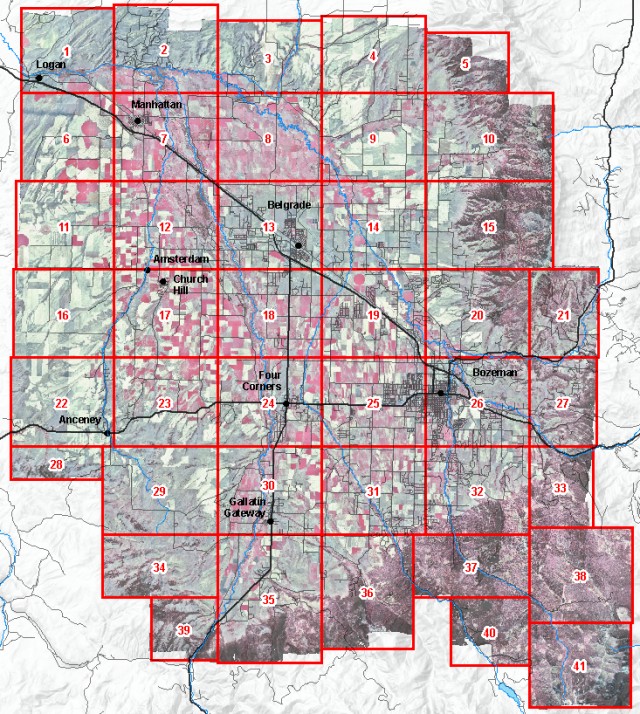
Color Infrared Aerial Photos
Gallatin Valley
September 9, 2001
Gallatin Local Water Quality District
Right–click on the photo you want from the map below and use your browser's
"Save Target As" function to download the image. These photos are in MrSID
format and Montana State Plane coordinates, units meters, datum NAD83.
Users of ArcMap software will need ESRI .aux files to accompany each image so that
ArcMap will understand their coordinate system, or "spatial reference."
Users of some software may need .sdw world files to accompany each image to view
these images in their correct geographic locations.