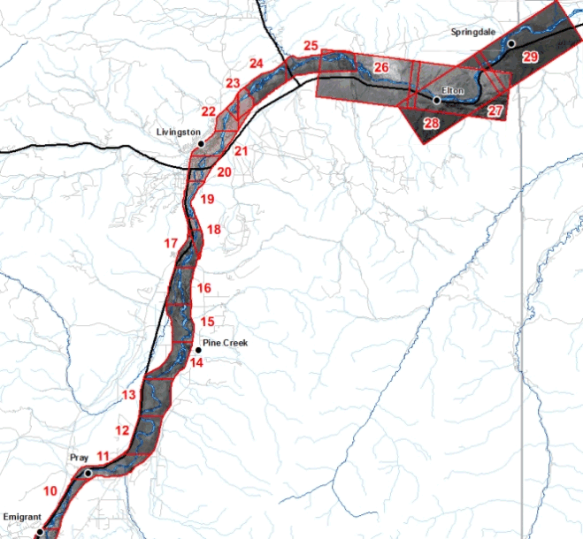
Color Aerial Photos
Yellowstone River Corridor, Park County – North Half
April, 1999
A georeferenced, ortho–rectified aerial photograph of each of the areas shown on the image below is available as a MrSID image. To download an image, right-click on it and use your browser's "Save Target As" function.
Images 10-17 and 24-25 are black and white images with a horizontal resolution of 6 inches. Images 18-23 are color images with a horizontal resolution of 6 inches. Images 26-29 are black and white images with a horizontal resolution of 2 feet.
The images are in MrSID format; Montana State Plane Coordinates, NAD83, units meters, and are between 10 and 70 megabytes. Users of some software may need ESRI .aux files or .sdw world files to properly use these images.
Click here to access images of the South half of Park County