Color Aerial Photos
Yellowstone River Corridor, Treasure County – 2007
October 15 - November 02, 2007
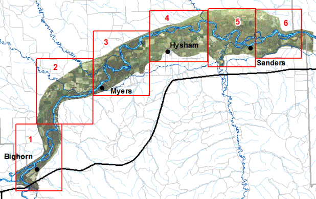
A georeferenced, ortho–rectified aerial photograph of each of the 6 areas
shown on the image below is available as a MrSID image. To download an image, right-click
on it and use your browser's "Save Target As" function. You may also
use the same method on the following link to download the entire area in a single MrSID image (2,368 megabytes).
The images have a horizontal resolution of one foot and are in Montana State Plane
Coordinates, NAD83, units meters. Each image is about 40 megabytes. Users of ArcMap
software will need ESRI .aux files to accompany each image so that ArcMap will understand
its coordinate system, or "spatial reference." Users of some software
may need .sdw world files to accompany each image to view these images in their
correct geographic locations.