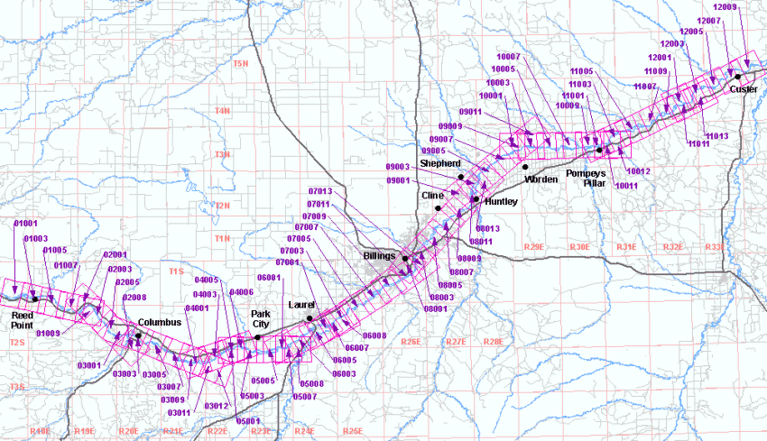
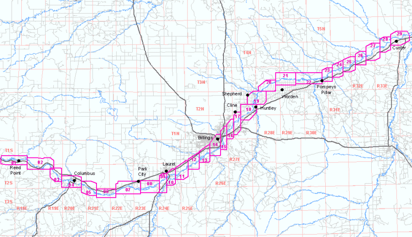
Color Aerial Photos
Yellowstone River Corridor, 1997 Flood
Georeferenced aerial photos of the areas shown on the maps below are available.
These photos are NOT orthorectified – they should be used to see what the
area of the photograph looked like in general rather than to determine the location
of any object that can be seen on the photos. The photos were taken two days after
the peak flood stage of 15 feet on the Yellowstone River in Billings.
Two sets of images are available. The first set consists of 29 mosaics arranged
so that the white no-data areas from adjacent images do not obscure each other.
The images have been resampled to a horizontal resolution of 0.4572 meters, or 1.5
feet. The second set of images are 69 individual aerial photos, and their resolutions
vary from 0.356 meters to 0.496 meters. When these photos are displayed together
with GIS software, the nodata areas of some photos will obscure parts of other photos.
The images are in MrSID format are in Montana State Plane Coordinates, NAD83, units meters.
Users of some software may need ESRI .aux files or .sdw world files to properly
use these images.
Photo Mosaics
Right-click on one of the numbered areas and use your browser's Save Target
As function to download an image. These images range between 7 and 17 megabytes
in size. Metadata
Individual Photos
Right-click on a photo number and use your browser's Save Target As function
to download an image. These images range between 18 and 35 megabytes in size. Metadata