Montana Geographic Names Advisor
Geographic Name Change Request
Nursery Creek
Jefferson County, Montana
Status =
Approved
| Description |
stream,
1.4 miles long,
heads 4.5 miles south of Jefferson City and flows generally south to enter Muskrat Creek |
| Location |
46°18’18”N, 112°01’52”W, |
| PLSS Location |
Section 6, Township 6 North, Range 3 West and Sections 30 and 31, Township 7 North, Range 3 West |
| Proposal |
application change to recognize local usage |
| Proponent |
Montana Water Quality Planning Bureau |
| Administrative area |
Bureau of Land Management, Beaverhead/Deerlodge National Forest |
| Previous BGN Action |
None |
| See also |
|
| GNIS ID |
788339
|
| Local Usage |
Nursery Creek
|
| Published |
Nursery Creek, in part: (USGS 1950/67, 1995; Jefferson County highway map 1973)
|
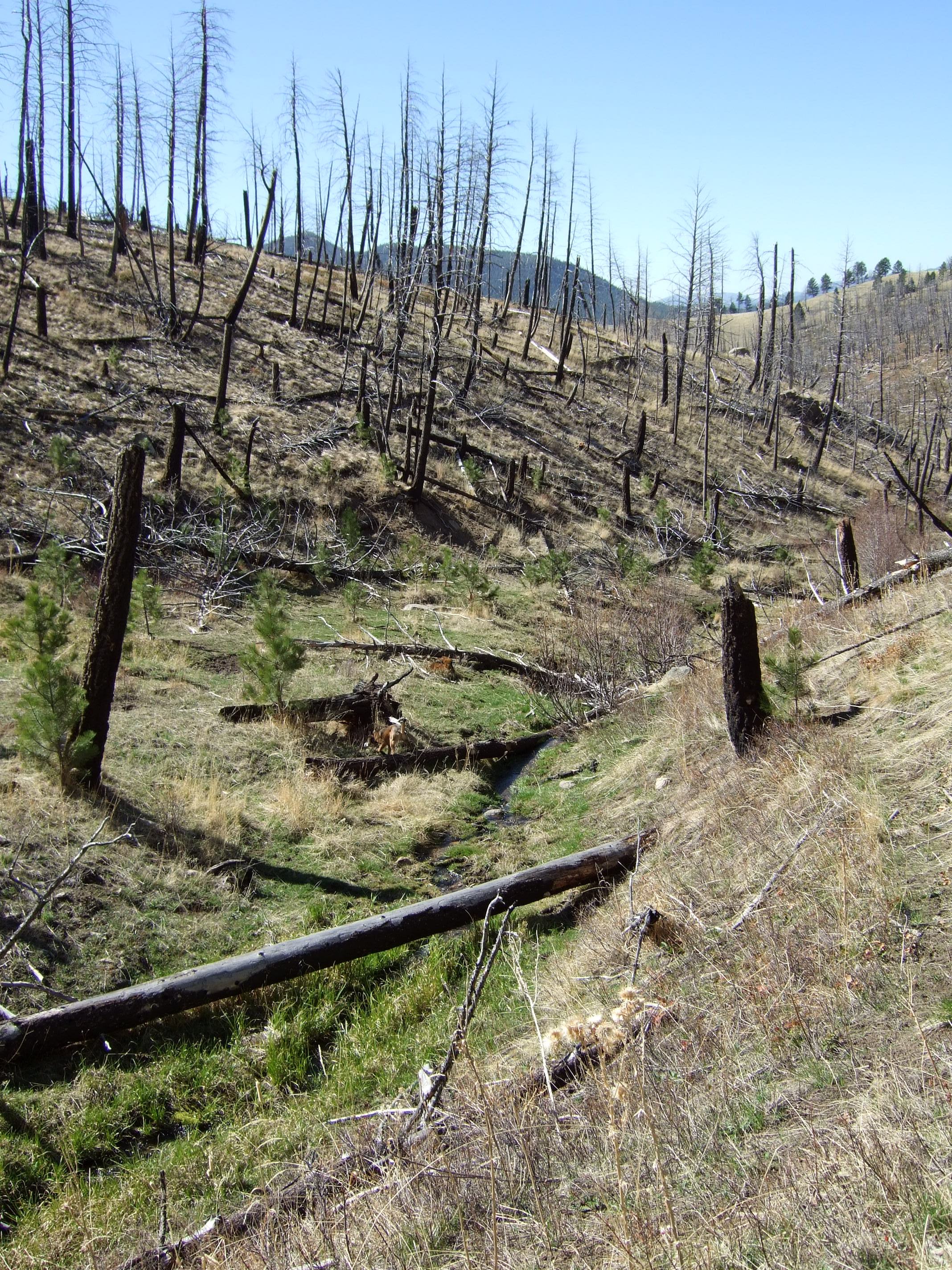
This proposal is to change the application of the name Nursery Creek for a small stream in Jefferson County. The stream heads within the Elkhorn Wilderness Study Area administered by the Bureau of Land Management, while the lower 800 feet of the stream fall within the Beaverhead/Deerlodge National Forest. Nursery Creek is a tributary of Muskrat Creek and there is no issue with the location of its mouth. However, a short distance upstream, the stream splits into two branches, with the name applied currently to the more westerly one.
The Montana Department of Environmental Quality (DEQ) Water Quality Planning Bureau believes this is incorrect and is proposing that the name should be moved to the easterly branch, which is more prominent and contains more water (this is confirmed by imagery and by the depiction of the stream in the National Hydrography Dataset). The USGS 1:62,500-scale topographic map published in 1950 and revised in 1967 only shows and labels the western branch, whereas the 1:24,000-scale map, revised in 1995, shows both branches and depicts the eastern one as perennial and the western one as intermittent. The 1973 Jefferson County highway map also only shows and labels the western branch. A local road named Nursery Creek Road is located just to the southwest of the area in question, closer to the currently labeled stream. DEQ field crews report that there is no visible stream channel for the western branch and the eastern branch normally carries water (see image links below).
The Montana Water Resources Division believes the proposal falls under jurisdiction of state law (Montana Code Annotated Title 85, Part 2, Section 131) that says such a name change must be approved in District Court. The Geographic Names Advisor supports the proposal as a correction to a cartographic error rather than a watercourse name change that the law would be applicable to.
The Forest Service has no objection to the proposal. The Bureau of Land Management was asked to comment but no response was received, which is presumed to indicate a lack of objection to the change. A copy of the proposal was forwarded to the Confederated Salish and Kootenai Tribes of the Flathead Reservation, which is federally recognized, but no response was received, which is presumed to indicate a lack of an opinion.
|
| Images |


|
| Montana Geographic Names Advisor Recommendation -
Support
(Tuesday, August 5, 2014)
|
| Domestic Names Committee Decision Date -
Thursday, December 11, 2014 |
Domestic Names Committee Discussion -
A motion was made and seconded to approve this application change.
Vote: 11 in favor
0 against
0 abstentions
|
